River Rhee
John Roadley
")
")
 R")
")
")
")
")
 (1)")
 (2)")
")
")
")
 (2)")
")
Rhee or Cam?
A look at studies and maps of the last 200 years of South Cambridgeshire rivers leaves one confused. Is the source of the River Cam at Ashwell Springs in Hertfordshire or near Debden in Essex? Why is one length of the river called ’Granta’ or ‘Granta or Cam’ or ‘Cam’ depending upon which bit of a map you look at? Similarly, why is another length called ‘Rhee’ or ‘Rhee or Cam’ or ‘Cam’?
Whatever the answers to these questions, the river that forms Harston’s western parish boundary with Haslingfield (and a little bit of Barrington) rises in Ashwell and and is known by Harstonites as The Rhee. In fact the river forms the boundary line of 18 parishes.
Obviously the river has been a source of water, food and power as well as a means of transport, defence and recreation. It is, therefore, not surprising that a settlement developed beside it and altered its course.
Early occupation by the river
Evidence of early occupation by the river was discovered and reported on by Leonora O’Brien in Bronze Age Barrow, Iron Age Settlement and Burials, and Early Anglo-Saxon Settlement at Harston Mill, Cambridgeshire.
A Bronze Age barrow and pit were discovered. Later Iron Age circles of posts, a crouched burial, a settlement of five roundhouses, four-post granaries, rubbish pits, 189 grain storage pits, (many of them containing human and animal remains), and pottery vessels were discovered. The proximity of the river to the position of Iron Age finds is shown in the plan.
A limited amount of Roman pottery and quern fragments were found. However, much more Anglo-Saxon evidence was found including sunken featured buildings, three ancillary structures, rubbish pits and ditches, wool-processing and weaving equipment, dress fittings and personal effects.
Changing course of the River
Agricultural practices over the centuries have had an effect on the course of the river but within Harston parish three obvious changes are in the area of the Mill and the Manor. With over 1000 years of milling, numerous replacement mills and changing technologies at the site, the course of the river will have been changed to suit the millers’ needs.
The first change, or perhaps more correctly, addition to the river was the construction of a loop of water creating a circular island opposite the grounds of the Manor. Described in the 1951 sales brochure for Harston Manor and Manor Home Farm as ‘an island spinney with view of mill,’ it is accessed via a wooden footbridge in the Manor grounds. The date when this loop was created is not known but it was shown on a 1799 map of the area.
The second change is upstream from the Mill where the river follows three sides of a man-made rectangle rather than following a straight line. In the 1951 sales brochure, this area is described as ‘The Holt (about 1 acre fishing in loop of river)’. Again a date for this is not known but it too appears on the 1799 map.
The last change of course here was between 1970-72 when the Great Ouse River Authority diverted the river away from the mill, water power having been replaced by electricity in 1963. Nigel Schoepp remembers that the adjoining meadows were used for cattle and hay. When the river around it and a weir put in, the spoil they dug out was put on the old meadow and ruined it, as it was never levelled out and lots of Willow was allowed to grow.
Focus of a civil war battle
With the whole of the village to the east of the river, it provided the early inhabitants with a defensive barrier to any incursions and any crossing point was a strategic position. There was a ford somewhere around the church and mill area which apparently became the focus of a Civil War battle in 1645 between the Royalists who occupied Haslingfield and Cromwell’s troops who held the ford (click here for details).
Reachable by boat from Cambridge
There is no evidence that this stretch of the river was used for anything other than recreational transport although small craft may have been used in past times. Some local families had boathouses for their pleasure craft. The Willers family had one for their punt at Riverside on Haslingfield Road and the Smiths who owned the Mill had one.
This village was also reachable by boat from Cambridge. The Cambridge Independent Press of 22 April 1871 reported that three men rowed their boat from Cambridge to Harston and left their boat by the riverside to visit the village. On their return the found that a bottle of sherry, 4 bottles of lemonade, a pewter mug, a pipe and a pair of gloves were missing. Three Harston men were charged with robbery.
Fishing
The river must have provided a source of food for the earliest settlers but there is little evidence of any ‘commercial’ fishing. Within the grounds of the Manor there are two rectangular fishponds thought to be the original ones mentioned in Domesday Book. They are fed by water coming into the first pond from the river, fed into second pond, and then returned to the river.
There was a village character in the late 19th century, Owen Cambridge, who was known as ‘The King of The River’. In Helen Greene’s book on Harston she writes that he got this name because he was always fishing. He used a kind of draw net for catching his fish and was rarely seen without it hanging over one shoulder. He was frequently had up for trespassing although the use of the net was not then illegal.He also caught eels in the traps he made.
Large pike, roach, dace, perch and occasionally trout were caught. There is still a Rhee Trout Club sign pronouncing ‘Fishing’Strictly Private’ near the road bridge over the river. The club was set up by Frederick Willers who owned this stretch of river and meadow and Keith Crow a local farmer who rented land adjoining the meadow and went as far as the weir at Haslingfield. This stretch was used solely for themselves and their friends and acquaintances. The fishing rights from the other side of the bridge up to Barrington were owned by Royston Angling Club. Frederick’s son Keith recalls that About 40 years ago the river was electronically fished by the River Board and the coarse fish used to stock other rivers. The river was then re-stocked with trout.
Obviously the river has long provided a source of enjoyment for the village children. Harold Northrop who was a child here in the early 1900s recalled they used to catch sticklebacks and red breasts (small fishes) and keep in jam jars.
A Water Mill since before Domesday
The Domesday Book, written in 1086, records that there was a water mill here. Water milling of a variety of products continued here until the 1980s. (click here for more information on the mill)
Houses under water and livestock lost
The worst documented flood was in August 1879 when a thunderstorm lasted for 7 hours. The lower floors of most houses were under water and many livestock lost. The river was described as a swirling flood. A baker & his cart tried to cross the ford, the cart was overturned, the loaves floated down the river and it was only with great difficulty that the horse and baker were saved.
Later on the local authority took steps to prevent such major events. Jim Starr and Brian Willers recall that ‘in those days the rivers were different as they were dredged every two years to remove the silt to avoid the flooding that we get today. Fred Collins and Harry Warren’s used to do the work full-time weeding and maintaining them, with the edges cut. At the end of the day when the rivermen had gone, village boys would ‘borrow’ their punt.
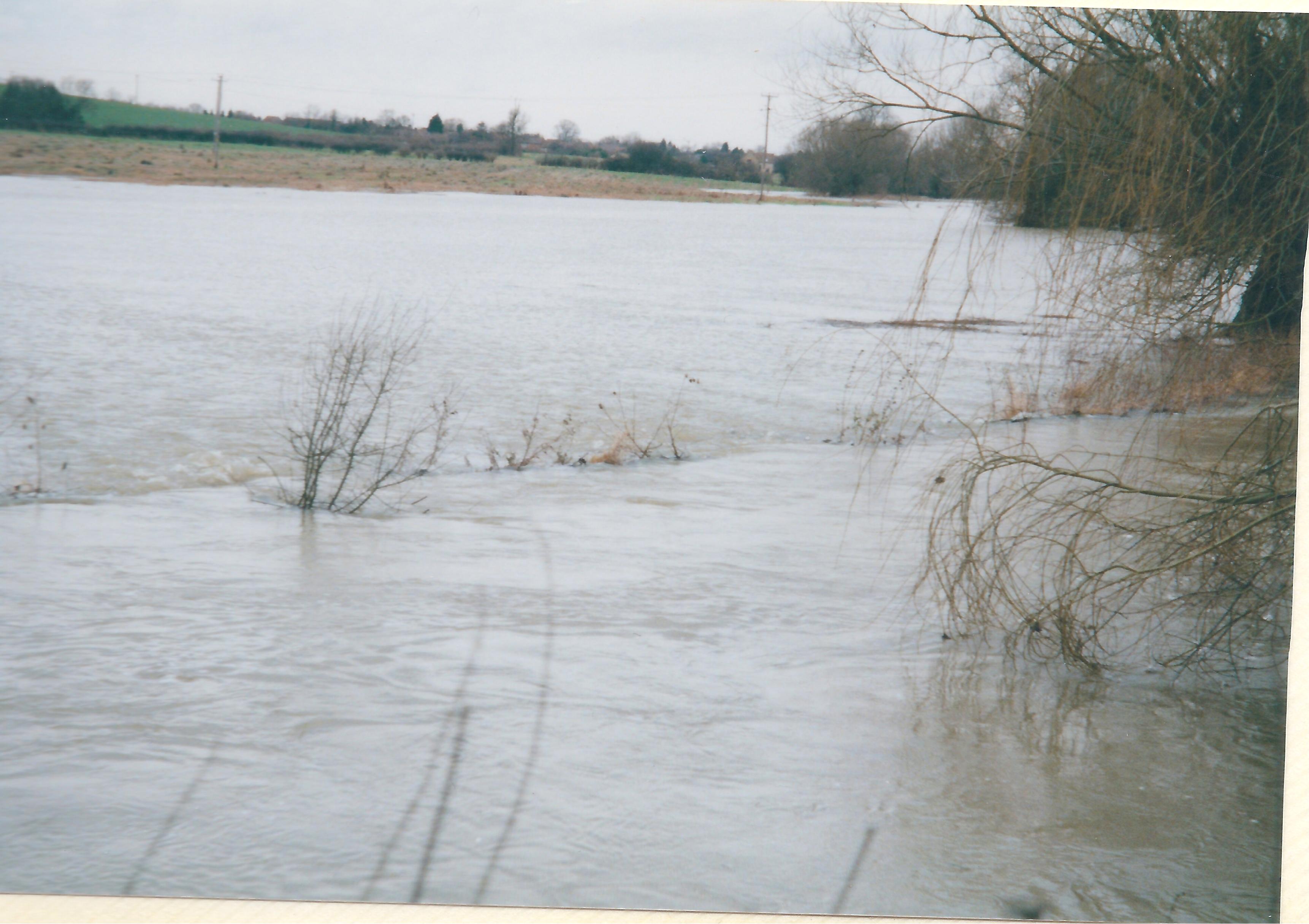
Inspite of work like this and more comprehensive flood protection schemes, a river in flood is often too powerful to halt as these photos show.
A magnet for young and old alike
Rivers have always been a magnet for young and old alike. The Rhee is far less accessible to villagers now than it was, particularly around the Mill area. This was a wonderful area for recreation until the site owners in the 1980/90s closed off all access to the villagers. People have told us about the river in their youth.
Janet Bennett recalls ‘We played ‘Pooh sticks’ in the river at the end of the village (Haslingfield Rd). We also went to a place in Haslingfield to swim in the river. We children also swam in the river down from Hauxton Mill and Hauxton Pest Control. Goodness knows what went into the river!’
Maureen Elwood remembers that in the 1940s ‘the river was very popular in the summer when several families would come down to picnic and swim or paddle in the river. The river had different named sections. One was called The Mens which was deep and good for diving. Snails Corner was named for obvious reasons and where the children played the river had a sandy bottom and not much mud’.
Jim Starr was in the scouts and recalled ‘they had a campfire at Burnt Mill bridge and used Mr Crow’s meadow beyond the end of Button End. Where it curves round and you come to the river the young ones would go swimming. You could stand up in it easily at that point.
Colin Pettit remembers kids would ride on the river in the old tin baths that people got rid of once their houses were modernised. The river was only knee deep near the Mill but was a bit deeper as you went nearer to Haslingfield.
Brian Willers recalls Fred Willers teaching kids how to swim near their boathouse by attaching a rope round their waists. They also used to swim at the back of Harston Mill and towards Hauxton.
However, not all forms of recreation would meet with our approval today. Under the proud banner headline ‘Eastern Counties Otter Hounds Two Kills’, the Chelmsford Chronicle of 18 July 1930 reported ‘These hounds paid another visit to the Cambridge district this week and again showed excellent sport. Meeting at Harston bridge, they drew up the Rhee and put down an otter at the old coprolite works. A very fast hunt downstream followed. Once on landing near Hoffer’s Brook, a hound nearly accounted for the otter but, getting away, and still going downstream the hunt continued. Shortly after crossing over to the backwater near Harston Mill, the hounds accounted for a fine bitch otter weighing 20lb. This was only about a quarter of a mile from where they had met in the morning although they had covered some 7 miles in the course of the hunt. This was a creditable performance on the part of the hounds and huntsmen, for the Rhee hereabouts is deep and sluggish and a difficult stream to hunt.’
Tragedies
Inevitably, where there is water, there will be tragedies and Harston has had its share.
The Cambridge Chronicle & Journal of 30 July 1796 reported that on Saturday, the 23rd inst, an inquisition was taken at Harston, before Mr Ingle, one of the county coroners on view of the body of Robert Tuck junior, who bathing in the river unfortunately got out of his depth and was drowned.
The Cambridge Chronicle & Journal of 19 June 1812 reported on the ‘Inquisition’ at The Swan on the body of Richard Wallis, aged 20, who drowned in the river. As he drowned in shallow water and had been ‘absent’ for only 3-4 min, it is supposed he had a fit, or cramp.
The Cambridge Independent Press of 8 December 1893 reported that Dr William John Midelton, surgeon of Harston, examined the body of a boy (Wilfred Edgar Griggs, 12y) who died in the river. The horse (of a horse & cart) went out of control; the boy was thrown out, and 2 quarters of beef fell on top of him, and he could not be pulled out before he drowned.
The Cambridge Independent Press of 4 April 1913 reported on the death of a villager, Frederick Barker, who went missing when cutting vegetation. His body was found in the river but left there by the villagers until the police arrived. This earned them a rebuke from the coroner who said ‘If you see a man in the water, if you can get him out without any danger to yourself, do so because he may not be dead. If a man is a man, he should do something do save a fellow creature.’
No Comments
Add a comment about this page