The Footpath
Duncan Bond with additional pictures & info by H Roadley

 R")


R")
 Rc")

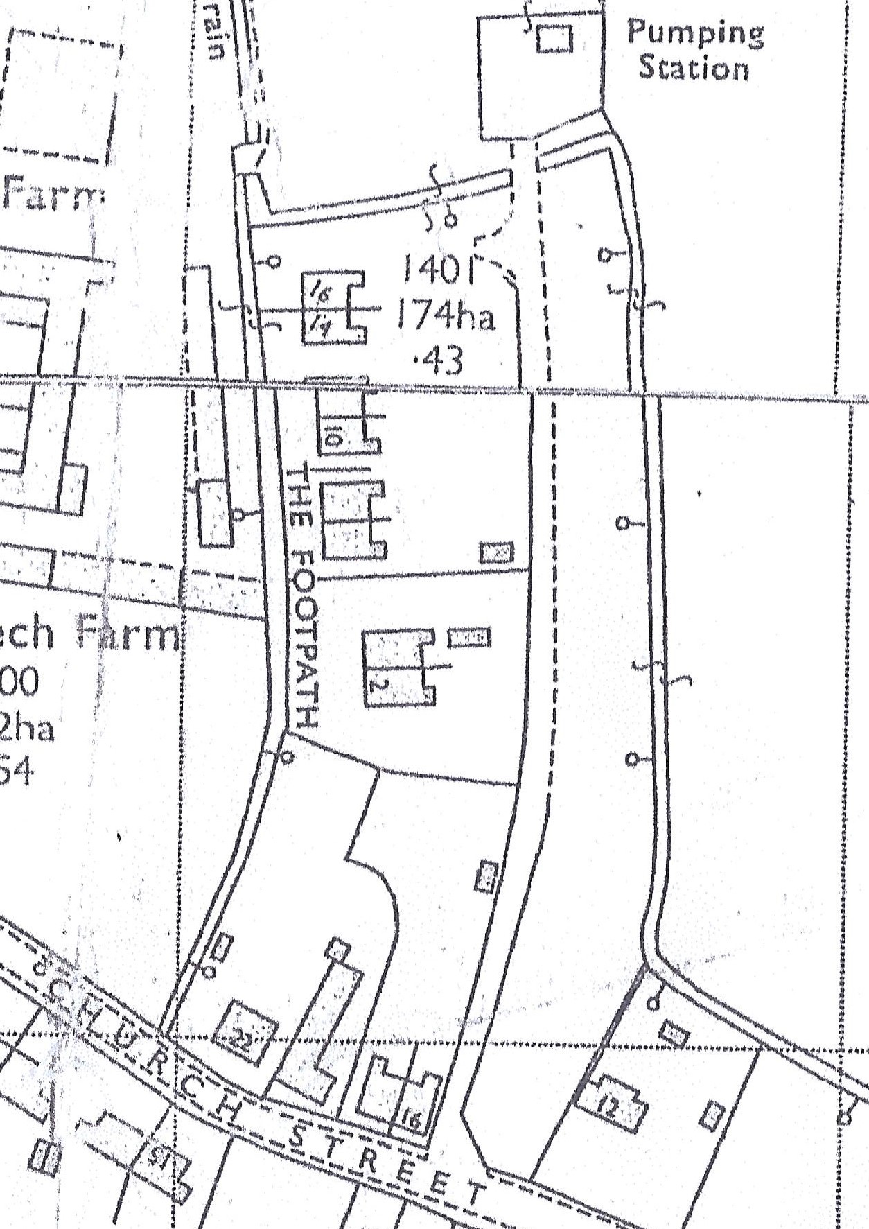
The Footpath is located at right angles to Church Street with its front gardens accessed from the public footpath, named The Footpath, and its back gardens accessed via a concrete access road to the right of 16 Church Street. Four pairs of semi-detached houses were built after the 1924 (Wheatley) Housing (financial provisions) Act which provided funds for local councils to build council houses. The land was originally a field (numbered 113 on 1886 map) owned later by Jesus College and as the map shows along the east side of the site were a row of old cottages which were demolished in the 1930s as unfit to live in.
The Footpath built in 1920s (by Duncan Bond)
These were originally all semi-detached Council houses built after 1924 of solid wall construction with Burwell white bricks in lime mortar, a slate damp proof course and a slate roof. These were some of the last solid wall houses built in the UK. By 1930 most new builds would have been of the modern brick cavity wall construction method. No 8 was built in 1929.
Each house, as built, had downstairs a front room with fireplace, kitchen/living room with cooker range, scullery (utility) room with a copper water boiler and a under stairs pantry. Upstairs had three bedrooms. The two largest were provided with small cast iron coal fireplaces.The windows were of dense pine wood and had small rectangular panes of glass. There was no electricity installed as built or gas (this finally arrived in the 1980’s) or water which was originally fetched by hand with buckets from the well at the Green. Each had an outside toilet. Each house also had a fruit tree in the back garden.
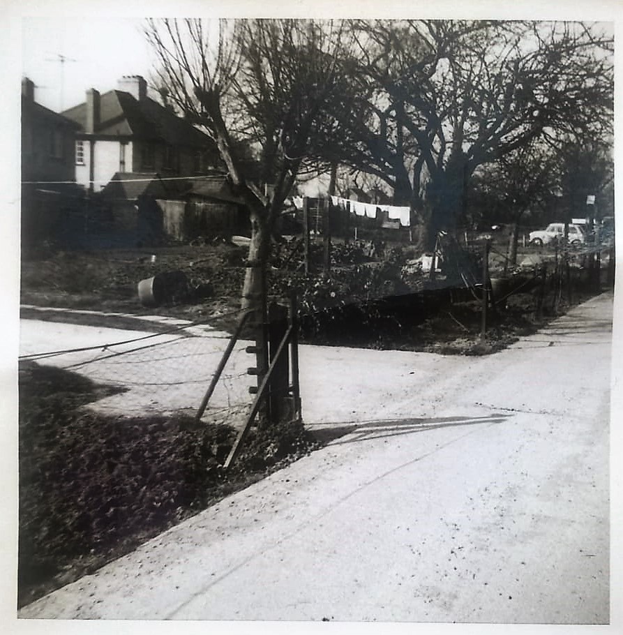
By the 1960s
The picture shows the back gardens of the houses in 1966 which by then had running water in the scullery (utility) room and electricity. The original electrical allowance by the Council to tenants when first installed for each house was for 3 pendant (ceiling) lights and one 5 amp socket. The side chimneys for a copper boiler in the scullery and the outdoor toilet blocks were all removed by 1969 when the council added a new downstairs bathroom to each house and a comprehensive electrical rewiring.
When the village got mains sewerage in the late 1960s one drain runs under the undeveloped land along the east side of the access road to the footpath.
Later changes
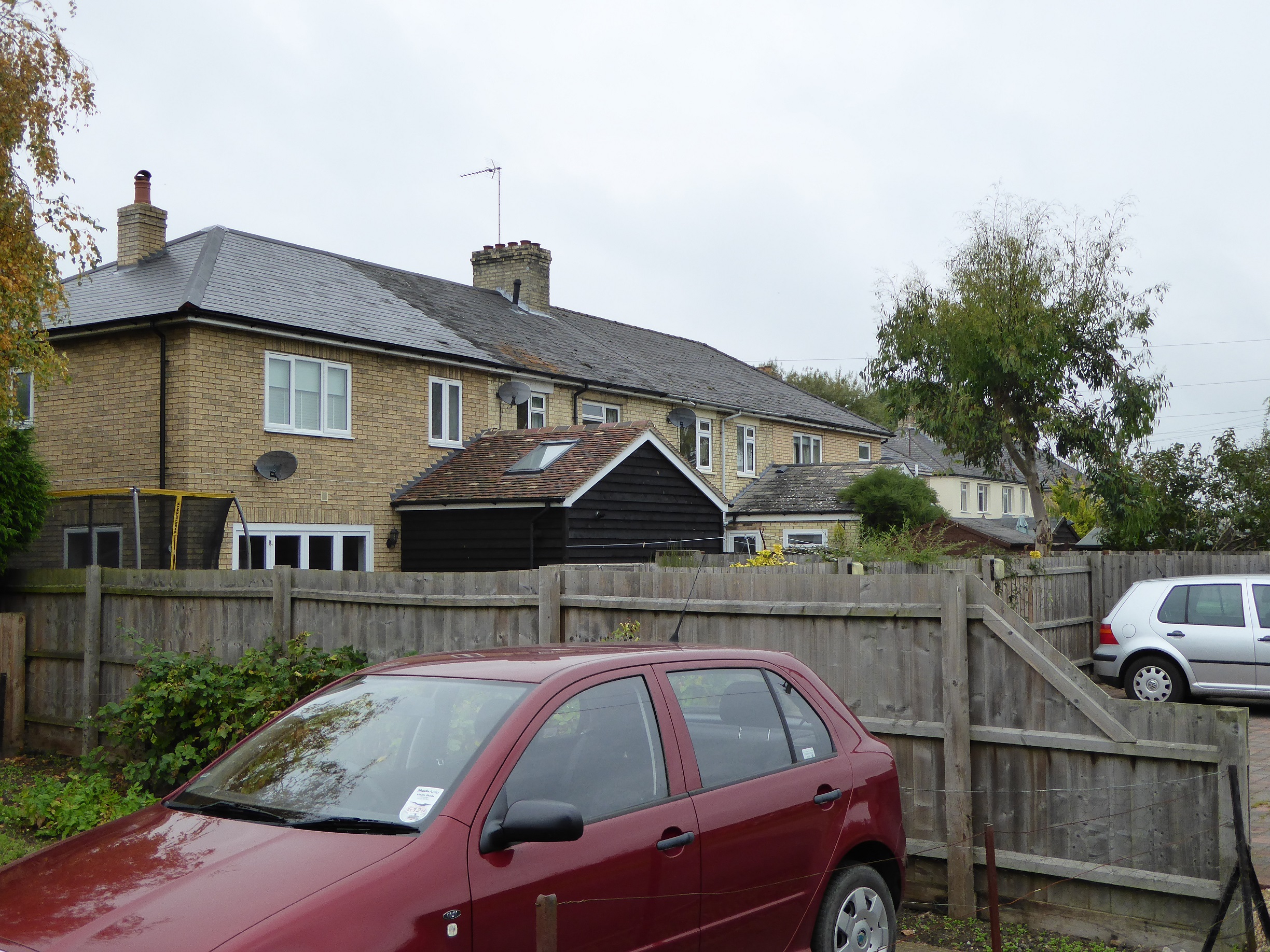
Chris Thomas lived at No 4 The footpath around about 1968. He sold some of his land and No 4a was built about 1985. No 4 was 3 bedroomed and has lean-to outdoor bathroom on ground floor. It has some wooden and some concrete floors.
The row now has Nos 2a, 2, 4, 4a, 2a and 4a attached to the original semis between them.
No 8 was renovated in 2000.
No Comments
Add a comment about this page